
Trace a Burlington Street Address
For a Burlington street-by-street question, begin with the physical parcel rather than a name search. The Town's GIS MapXpress viewer can identify a selected parcel and place it among adjoining lots. Its public information can point to a property card, a situs address, a parcel reference, and an owner or mailing clue. That is useful evidence, but it is not a list of everyone who lives in a home. The next records answer different questions: a deed can show a transfer, a permit can date work, and a street list can put a household in an earlier period.
- Locate the address in MapXpress, select Parcel Information, and note the situs address, parcel or map-lot reference, owner clue, and any separate mailing address.
- Pan along the Burlington street and use the parcel polygons or the unofficial abutters output to distinguish adjacent lots. Use the measure tools only for map context.
- Search the current owner, prior owner, property reference, or deed date in Middlesex South MassLandRecords, selecting Burlington as the town when that filter fits.
- Open the transfer image when available and record the document number or book and page, recording date, parties, deed type, and legal-description or plan reference.
- For a past household, compare the correct year of a street list, phone book, voting list, newspaper, or census record. The state voter-status form is a one-person verification tool, not a street browse.
This sequence keeps the Burlington street directory tied to its strongest evidence. It also avoids turning a map label into an unsupported claim about present occupancy.
Read Burlington Street Parcels
The Town GIS information page says residents can view property record cards, print unofficial abutters lists, and work with zoning and aerial imagery. MapXpress exposes Full Extent, pan, zoom, previous and next extent, Parcel Information, and simple, path, and area measurement tools. Its layer list includes parcels, zoning, sewer, wetlands, soils, aquifer protection, FEMA mapping, contours, and several years of color aerial imagery. A street directory search uses those layers to orient a parcel, not to establish title.
The Burlington GIS parcel viewer shows the public mapping workspace used for this first address check.
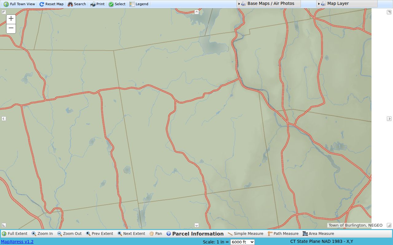
Once a parcel is selected, compare its map position with the registry's legal description or plan reference before treating a street address as the same thing as the legal parcel.
The Town publishes GIS data as is and does not promise its completeness or accuracy. For title, the recorded document and legal description carry more weight than a map label. A corner parcel may face one road while its situs address uses another; the map should be read with that possibility in mind.
Burlington Street Directory Search Fields
The official text confirms address, owner, and parcel-oriented property-card functions, but it does not publish a full live form or parcel-number syntax. Treat the inputs below as the verified routes, then read the labels that appear in the live viewer rather than guessing a format. An owner name can be a useful property lead, while an address or parcel selection keeps the search anchored to the Burlington lot.
| MapXpress route | Control type | Needed? | Verified use |
|---|---|---|---|
| Street or address | Text or map search | No | Address-keyed parcel route; exact autocomplete labels were not published in the text view. |
| Owner name | Text search | No | Officially described property-card capability; use the live viewer for its name format. |
| Parcel or map-lot | Text or map selection | No | Use the parcel label or assessor map reference; exact syntax was not published. |
| Parcel Information | Map tool | Practical | Identifies a selected polygon and leads the street-by-street inspection. |
| Abutters list | Output or print tool | No | Unofficial adjacent-parcel list, useful for checking nearby lots rather than occupancy. |
| Layers and measure tools | Map toggles and tools | No | Provides zoning, wetland, aerial, boundary, and distance context. |
A property card may supply ownership, situs and mailing information, assessment data, building clues, exemptions, and deed references. The exact populated Burlington card labels were not captured in the research, so each card should be read on its own terms. New owners may also take six months to a year to appear on a tax bill, according to the Town tax office, which is why a recent deed matters.
Burlington Records by Street Address
No one Burlington street directory source answers every question. The assessor layer establishes the parcel and current ownership clue. The Registry preserves the recorded land trail. Town permit records can date construction or alteration, while library material helps with older occupants. The table separates what each address-keyed source can support from what it cannot prove.
| Address record | Local keeper | Street-level evidence | Access path |
|---|---|---|---|
| Assessor card | Burlington Assessors | Owner, situs and mailing clues, parcel, assessment, building or exemption clues | Assessors, GIS, counter, phone, or email |
| Parcel map | Burlington GIS | Boundaries, adjoining parcels, roads, zoning, environmental and aerial context | Public MapXpress viewer |
| Deed index and image | Middlesex South Registry | Parties, recording date, document or book-page reference, legal description, liens, plans | Free web search and images; certified copies through the Registry |
| Permit record | Burlington Building and Planning | Address, record number, type, status, and associated public files when available | ViewPoint/OpenGov or a narrow records request |
| Street list or newspaper | Miles Historical Room and State Library | Historical address or household clues, depending on the volume | Library, Internet Archive selections, microfilm, or physical holdings |
Tax-taking notices are another limited municipal source. They can identify a property address, assessed owner, registry book or page, and a delinquent amount. They document a record event, not a conclusion about a person. Court and probate dockets may contain address clues too, but sealed, impounded, and restricted material stays outside ordinary public access.
Note: The address chain is strongest when each record is dated and compared, because assessor, tax, permit, and recorded-deed updates do not occur on the same schedule.
Follow Burlington Deeds Along a Street
Burlington lies in the Middlesex South Registry district. Use the MassLandRecords search for recorded land, registered land, plans, and the Unindexed Property Search for Book 1-1024. The recorded-land search offers name, document, book, property, and recorded-date modes. Its visible controls include party name rows, party type, document type, town, a compressed or like choice, and date-from/date-to fields. Select Burlington when using the town filter, then vary the mode if a name search misses the instrument.
The Middlesex South Registry announced that grantor indices for 1896 through 1973 became available online on October 21, 2025. The official web copy of a recorded document is free, while a certified document copy costs $1 per page and a registered-land certificate costs $5. The Registry warns about solicitations that offer a deed copy for $118 even though the official online copy is free.
That grantor-index update makes it easier to move backward from a recorded transfer, but the regular web index does not publish one universal earliest year. When the online trail ends, use the Book 1-1024 option, ask Registry staff about the appropriate mode, or research at the Cambridge office.
- Parcel
- A mapped unit of land used by the assessor. Its map label helps find a property, but it is not the legal title description by itself.
- Situs address
- The location of the parcel or building. It can differ from the owner's tax mailing address.
- Grantor and grantee
- The grantor transfers an interest; the grantee receives it. Reversing those roles is a common deed-chain error.
- Criss-cross directory
- A directory arranged by address or street rather than only by name, when the particular volume includes that format.
Search Burlington Permit Addresses
Burlington's ViewPoint/OpenGov portal is another street directory tool because it begins with a location. Select Search, enter the first part of the address, choose the matching location, then open the Records tab. The public results can show a record number, type, and status. A selected record may have Records and Details tabs plus a Files link for associated submissions. Building, electrical, gas, sheet-metal, zoning, appeal, conservation, health, and fire-related entries can help date activity at an address.
The 2024 Town report counted 3,470 permits, including 1,089 residential building permits, as well as 98 complaint or violation responses. It also says historical building files and plans are being converted from microfiche to PDF. An older file may therefore exist without being a simple online document. Ask the relevant Town custodian for the record type, address, date range, preferred electronic format, and a fee estimate rather than assuming that an absent file never existed.
Burlington Voter Records by Street
The state My Voter Registration Status page does not create a public Burlington street directory. It requires a first name, last name, date of birth, and residential ZIP for one person. A match can return registered or pre-registered status, active or inactive status, a polling location, and elected officials. It does not provide a public browse of every resident on a road, and a nickname may fail.
Local voter files are held by Burlington election officials through the Town Clerk. Massachusetts makes local voter information public subject to important exclusions, while the statewide central list is not public. Phone and email, veteran status, permanent absentee status, minors' records, and confidential-voter information are withheld. A written request should name Burlington, identify the desired list and date range, request paper or electronic format, and ask about the current fee. A public list does not show ballot choices or prove every person at an address.
Note: If a person recently moved, the state search tips recommend trying the ZIP tied to the last registered address and allowing two to three weeks for updates.
Burlington Streets Before Modern Growth
Old addresses deserve extra caution. Burlington was part of Woburn and known as Woburn Second Parish before it became an independent town on February 28, 1799. Earlier material may be filed under Woburn, Second Parish, Shawshin, or Shawsheen rather than Burlington. The town stayed largely rural for nearly three centuries, then its population rose from 3,250 in 1950 to 12,852 in 1960 and 19,473 in 1965. New roads, subdivisions, and changed numbering can make a modern address a poor search term for an early list.
Use an old map, plan, town annual report, street list, and deed legal description together. The Town's official zoning map is the best local check when an address sits near Bedford, Billerica, Lexington, Wilmington, or Woburn. A ZIP, a nearby town name, and a legal Burlington parcel can diverge at the edge, so MapXpress and the Registry provide a better municipal check than a mailing label alone.
Find Past Burlington Street Lists
For prior households on a Burlington street, the Miles Historical Room is the local fallback after property and deed records. Its collection includes street lists, phone books, maps, yearbooks, annual reports, newspapers, genealogy material, photographs, and microfilm. Selected street lists have been digitized through Internet Archive beginning in 1960, but each scan should be checked for its title, year, and completeness. Historical voting-list holdings at the State Library include 1946-48, 1948-49, 1978, 1980, and 1989.
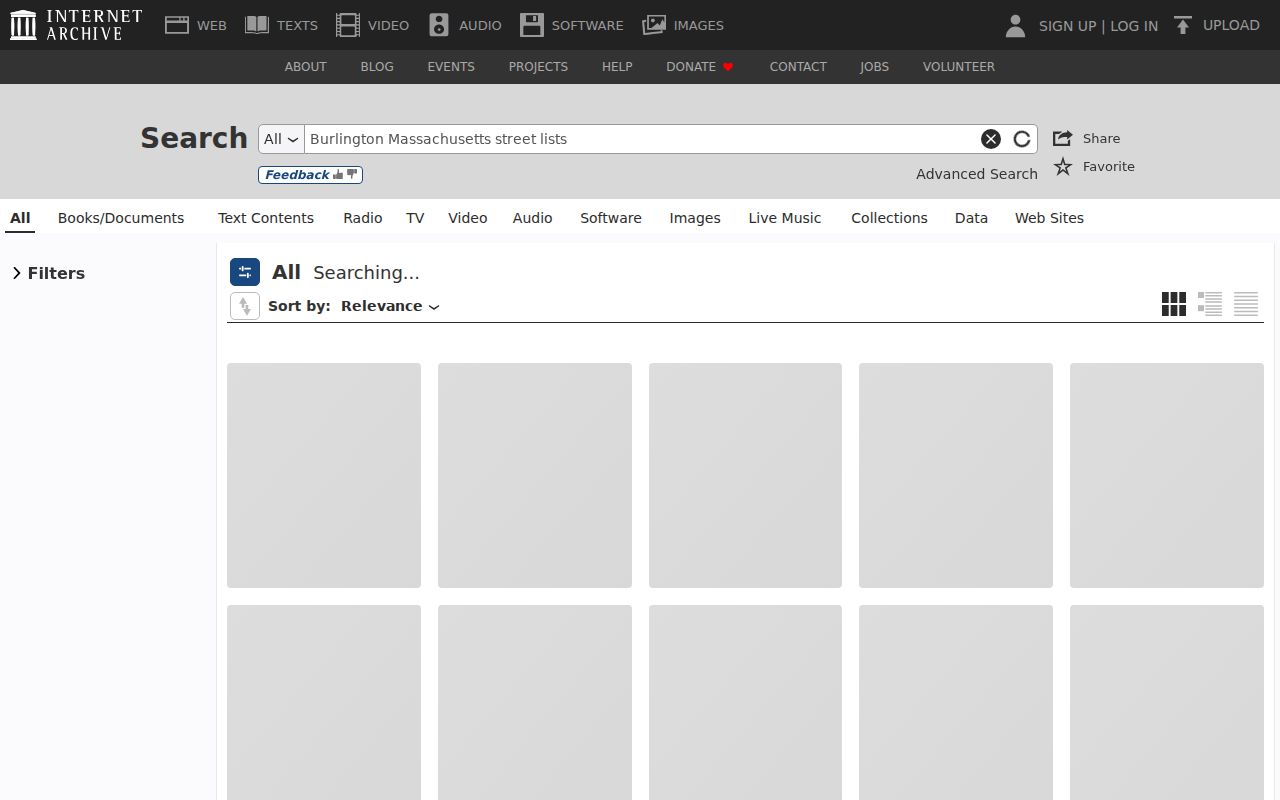
The image points to a search for selected digitized lists, not proof that every Burlington year or address appears online. Confirm the particular scan before drawing a household conclusion.
The historical shelf is described in more detail in the Burlington city directory collections. Here, the useful point is simple: a street-ordered section, if a volume has one, can place a name or household near an address in that year. It cannot be treated as a current resident list. The library's newspapers can then supply sale notices, obituaries, civic notices, or construction context.
Burlington Street Directory Limits
An address search cannot reveal a complete household. Registry records can name owners, trustees, attorneys, executors, mortgagees, and businesses; they do not function as a resident roll. The assessor mailing address may point to tax correspondence rather than occupancy. Renters and other household members may not appear in a land record at all. Utility customer information and Massachusetts motor-vehicle personal address data are not public street-search sources.
Some gaps are deliberate. Massachusetts Address Confidentiality Program participants may use substitute addresses, confidential voters are removed from public voter extracts, and court files can be sealed or impounded. Do not try to reverse-engineer protected information from a map, a street list, or a different public filing.
Lawful use. Burlington address records support personal, civic, family-history, estate, and property research. Do not use them to stalk, harass, threaten, or harm anyone; Massachusetts law provides penalties and protective-order remedies for that conduct.